Jakarta hosts successful trade Mission on Geodata and Earth Observation for Agri-Food and Water
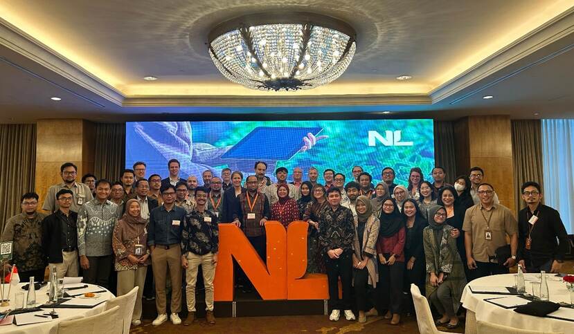
The trade mission on Geodata and Earth Observation in Agri-food and Water was successfully held in Jakarta on 24-25 February 2025. Bringing together experts, policymakers, and industry players from both countries to explore how Dutch expertise in geospatial technology can support Indonesia’s growing demand for data-driven solutions in food security.
Agricultural production and food security are increasingly at risk due to climate change, land degradation, dwindling freshwater resources, pests and diseases, declining crop yields, rising input costs, and a shrinking rural workforce with an aging farmer population. To tackle these challenges, data and information play a crucial role in equipping governments and farmers with the insights needed for effective planning, monitoring, and timely interventions.
The Netherlands has a strong track record in sustainable agriculture, backed by advanced digital innovation, geospatial technology, and earth observation. Recognizing Indonesia’s growing need for timely and actionable information, Dutch expertise aims to support local stakeholders in enhancing food security, sustainable agricultural production, and efficient land use. This initiative is expected to create greater collaboration and economic opportunities between both countries.
Nine (9) Dutch companies participated in the trade mission: Digireg International, Kadaster International, Netherlands Space Office, Rabobank – Acorn Program, Satelligence, Space4Good, Stichting OpenGeoHub, TerraSphere, and the University of Twente – Faculty ITC. Further details on their expertise can be found in Mission Booklet below.
Insightful knowledge exchanges, building connections, and exploring potential cooperations
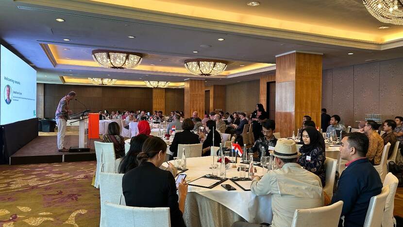
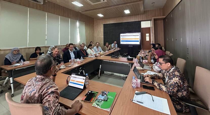
The first day, on 24 February 2025, we had “the Netherlands – Indonesia Forum on Geodata and Earth Observation in Agri-food and Water” provided a platform to align Indonesia’s needs with the Netherlands’ expertise, fostering opportunities for collaboration in areas such as monitoring land use, agricultural crop monitoring and yield predictions, track and traceability, and improving agricultural planning and decision making to enhance food security. In total, more than 80 participants attended this forum ranging from government officials, private sectors, NGOs, and knowledge institutes.
The forum was opened by Joost van Uum, Agriculture Counselor of the Dutch Embassy in Jakarta, with a keynote speech from I Ketut Gede Ary Sucaya (Head of Center for Land Data & Information, Ministry of Agrarian Affairs & Spatial Planning).
Afterwards, we had insightful presentations from both sides, elaborating on the geodata ecosystem and its utilization in Indonesia and The Netherlands. Speakers included: Ruud Grim (Netherlands Space Office), Dr. Dheny Trie (Indonesian Geospatial Information Agency/ BIG), Ibrahim (Ministry of Agriculture), Luc Groot (Kadaster International), Yassir Ismail (ID FOOD), Willem van der Muur (The World Bank) and Saskia (ANGIN). The presentations from Indonesian partners were particularly impressive, demonstrating that Indonesia is already utilizing spatial and satellite data to some extent for agricultural planning. This underscores the potential for further cooperation.
In the afternoon, things became more dynamic with pitches from Dutch organizations and engaging three (3) discussion groups.
To wrap up an inspiring day, we concluded with a dinner hosted by the Dutch Ambassador Marc Gerritsen at his residence—an evening filled with great conversations and future collaboration opportunities.
Office visit for an in-depth exploration of cooperation
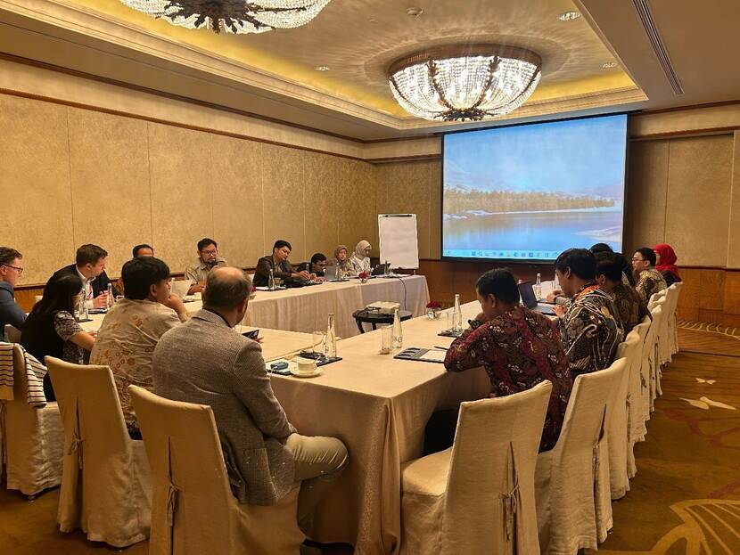
On the second day, 25 February 2025, Dutch delegation visited the Indonesian Geospatial Information Agency (BIG) in Cibinong. We were welcomed by Dr. Ibnu Sofian (Deputy at BIG) and his team. He shared insights on geospatial information in Indonesia, highlighting key challenges and opportunities. During the discussion, Dutch organizations & BIG exchanged knowledge on acquiring and utilizing geospatial data, including technical aspects discussion. We also had the chance to visit BIG’s data center, which stores Indonesia’s spatial information database.
After our visit to BIG, we continued to the Central Jakarta Land Office, part of the Ministry of Agrarian Affairs & Spatial Planning. We were welcomed by Firman Singagerda (Head of Land Office) and his team, who presented insights into Indonesian land administration and registration especially in Jakarta. He also introduced Bhumi and Sentuh Tanahku, applications that provide public access to spatial land information.

Looking ahead, the connections established during these two days hold promise for deeper collaboration. This forum marks an important first step towards strengthening partnerships in geodata and earth observation, ensuring a more resilient food systems.
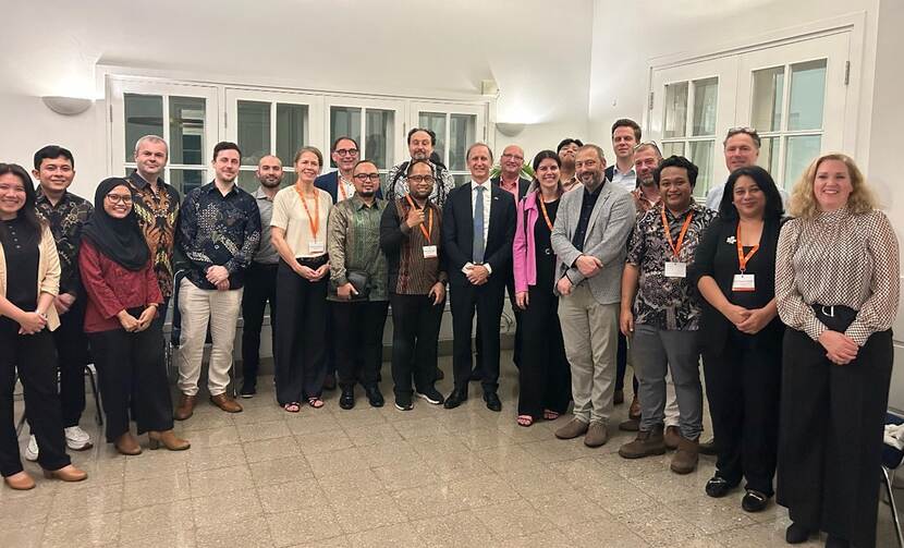
After completing the event in Jakarta, Indonesia, Dutch delegation departed for Malaysia to attend a forum on the same topic and participate in a field visit as this trade mission aim to explore opportunities in Indonesia and Malaysia.